


This section reviews the area, line and point styles built into Global Mapper.
Using the Area Styles panel users can configure how areas of a given type will be displayed in Global Mapper. Area fill, border style and color can be modified on a type-by-type basis. The Show Labels for Areas of This Type option allows users to turn area labels off on a type-by-type basis.
Area Types are shown in the Global Mapper Area Types table. Tables showing the Global Mapper Fill Patterns and Border Styles follow the Area Types table.
Global Mapper recognizes five field attributes as containing information for the display appearence of an Area Type. They are:
GM_TYPE=
BORDER_COLOR=
BORDER_WIDTH=
BORDER_STYLE=
FILL_COLOR=
FILL_STYLE=
The "FILL_ALPHA=" field attribute is recognized by Global Mapper to set an Area Type's transparency. Values for "FILL_ALPHA=" range from 0 (Transparent) to 255 (Opaque). To determine the transparency value setting simply multiply the percentage by 255 and round off to the nearest integer (e.g. 75% transparency 0.75 x 255 = 191.25, use 191).
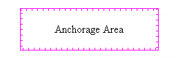
As an example, the default field attributes for the Anchorage Area Type are:
GM_TYPE=Anchorage Area
BORDER_COLOR=RGB(255,0,255)
BORDER_WIDTH=1
BORDER_STYLE=Comb (Right Only)
FILL_COLOR=RGB(255,0,255)
FILL_STYLE=No Fill
To change the type's transparency to 35% the FILL_ALPHA field attribute value should be set equal to 89 (0.35 x 255 = 89.25).
GM_TYPE=Anchorage Area
BORDER_COLOR=RGB(255,0,255)
BORDER_WIDTH=1
BORDER_STYLE=Comb (Right Only)
FILL_COLOR=RGB(255,0,255)
FILL_STYLE=No Fill
FILL_ALPHA=89
Global Mapper's View --> Background Color... color designation influences which areas can be seen. Any area whose color is the same as the Global Mapper Backgrond Color will not be seen. Example, for a white Background Color (RGB 255,255,255), the Snow or Glacier Area will not be visible.
| Global Mapper Built-In Area Types | ||||||||
|---|---|---|---|---|---|---|---|---|
| Area Type | Example | Fill Pattern | Fill Color | Border Width | Border Style | Border Color | ||
| Anchorage Area | |
No Fill | 0,0,0 | 1 | Comb (Right Only) | 0,0,0 | ||
| City Park | |
Solid Fill | 0,235,0 | 1 | Null | 0,0,0 | ||
| Country | |
No Fill | 0,0,0 | 1 | Solid | 0,0,0 | ||
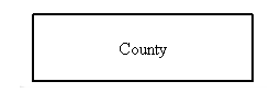
| County | |
No Fill | 0,0,0 | 2 | Solid | 0,0,0 | ||
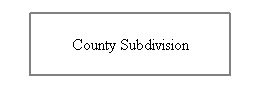
| County Subdivision | |
No Fill | 0,0,0 | 2 | Solid | 128,128,128 | ||
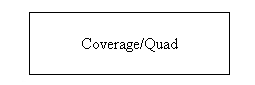
| Coverage/Quad | |
No Fill | 0,0,0 | 1 | Solid | 0,0,0 | ||
| Cropland | |
Solid Fill | 183,183,0 | 1 | Null | 0,0,0 | ||
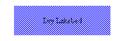
| Dry Lakebed | |
Intermittent Water Pattern | 132,130,255 | 1 | Null | 0,0,0 | ||
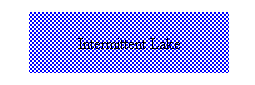
| Intermittent Lake | |
Intermittent Water Pattern | 132,130,255 | 1 | Null | 0,0,0 | ||
| Intermittent Stream/River | |
Intermittent Water Pattern | 132,130,255 | 1 | Null | 0,0,0 | ||
| Intertidal Area | |
Solid Fill | 192,240,188 | 1 | Null | 0,0,0 | ||
| Island | |
No Fill | 0,0,0 | 1 | Solid | 0,0,0 | ||
| Isobath Area | |
Solid Fill | 132,130,255 | 1 | Null | 0,0,0 | ||
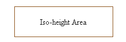
| Iso-height Area | |
No Fill | 0,0,0 | 1 | Solid | 128,64,0 | ||
| Lake, < 0.5 sq. mi. | |
Solid Fill | 0,0,211 | 1 | Null | 0,0,0 | ||
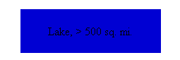
| Lake, > 500 sq. mi. | |
Solid Fill | 0,0,211 | 1 | Null | 0,0,0 | ||
| Lake, 0.5 - 1 sq. mi. | |
Solid Fill | 0,0,211 | 1 | Null | 0,0,0 | ||
| Lake, 1 - 5 sq. mi. | |
Solid Fill | 0,0,211 | 1 | Null | 0,0,0 | ||
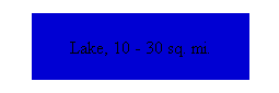
| Lake, 10 - 30 sq. mi. | |
Solid Fill | 0,0,211 | 1 | Null | 0,0,0 | ||
| Lake, 100 - 250 sq. mi. | |
Solid Fill | 0,0,211 | 1 | Null | 0,0,0 | ||
| Lake, 250 - 500 sq. mi. | |
Solid Fill | 0,0,211 | 1 | Null | 0,0,0 | ||
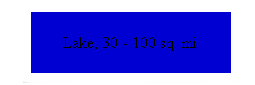
| Lake, 30 - 100 sq. mi. | |
Solid Fill | 0,0,211 | 1 | Null | 0,0,0 | ||
| Lake, 5 - 10 sq. mi. | |
Solid Fill | 0,0,211 | 1 | Null | 0,0,0 | ||
| Lake, Unknown Area | |
Solid Fill | 0,0,211 | 1 | Null | 0,0,0 | ||
| Land Area | |
Solid Fill | 220,212,148 | 1 | Null | 0,0,0 | ||
| Land Grant | |
No Fill | 0,0,0 | 2 | Null | 0,0,0 | ||
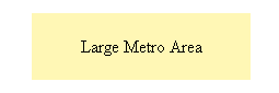
| Large Metro Area | |
Solid Fill | 255,247,181 | 1 | Null | 0,0,0 | ||
| Major National Park | |
Solid Fill | 0,235,0 | 1 | Null | 0,0,0 | ||
| Major River | |
Solid Fill | 0,0,211 | 1 | Null | 0,0,0 | ||
| Major State Park | |
Solid Fill | 0,235,0 | 1 | Null | 0,0,0 | ||
| Map Catalog Layer Bounds | |
Diagonal Cros-Hatch | 255,64,64 | 1 | Solid | 0,0,255 | ||
| Marine Info Area | |
No Fill | 255,0,255 | 1 | Comb (Right Only) | 255,0,0 | ||
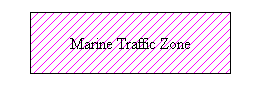
| Marine Traffic Area | |
Backwards Diagonal Cross-Hatch | 255,0,255 | 1 | Solid | 0,0,0 | ||
| Measurement | |
Horizontal Hatch | 255,0,0 | 5 | Striped | 255,255,0 | ||
| Metro Area | |
Solid Fill | 255,247,181 | 1 | Null | 0,0,0 | ||
| Minor River | |
Solid Fill | 0,0,211 | 1 | Null | 0,0,0 | ||
| Misc. Manmade Structure | |
Solid Fill | 255,64,64 | 1 | Null | 0,0,0 | ||
| National Park | |
Solid Fill | 0,235,0 | 1 | Null | 0,0,0 | ||
| Ocean | |
Solid Fill | 0,0,211 | 1 | Null | 0,0,0 | ||
| Orchard or Plantation | |
Solid Fill | 255,128,0 | 1 | Null | 0,0,0 | ||
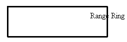
| Range Ring | |
No Fill | 0,0,0 | 3 | Solid | 0,0,0 | ||
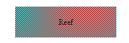
| Reef | |
Coral Pattern | 255,0,0 | 1 | Null | 0,0,0 | ||
| Regional River | |
Solid Fill | 0,0,211 | 1 | Null | 0,0,0 | ||
| Reservation | |
Solid Fill | 255,0,0 | 1 | Null | 0,0,0 | ||
| Rock | |
Solid Fill | 104,133,138 | 1 | Null | 0,0,0 | ||
| Salt | |
Salt Pattern | 192,102,192 | 1 | Null | 0,0,0 | ||
| Sand | |
Sand Pattern | 255,255,0 | 1 | Null | 0,0,0 | ||
| Scattered Trees | |
Solid Fill | 0,255,0 | 1 | Null | 0,0,0 | ||
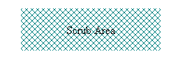
| Scrub Area | |
Diagonal Cross-Hatch | 0,128,128 | 1 | Null | 0,0,0 | ||
| Small Metro Area | |
Solid Fill | 255,247,181 | 1 | Null | 0,0,0 | ||
| Snow or Glacier | |
Solid Fill | 255,255,255 | 1 | Null | 0,0,0 | ||
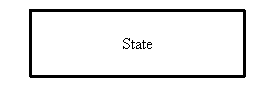
| State | |
No Fill | 0,0,0 | 3 | Solid | 0,0,0 | ||
| State Park | |
Solid Fill | 0,235,0 | 1 | Null | 0,0,0 | ||
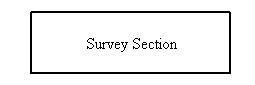
| Survey Section | |
No Fill | 0,0,0 | 2 | Solid | 0,0,0 | ||
| TIN Face Area | |
No Fill | 0,0,0 | 1 | Solid | 0,0,0 | ||
| Tundra | |
Solid Fill | 145,177,196 | 1 | Null | 0,0,0 | ||
| Unclassified Area Feature | |
No Fill | 0,0,0 | 1 | Solid | 0,0,0 | ||
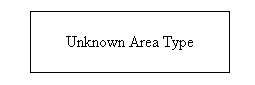
| Unknown Area Type | |
No Fill | 0,0,0 | 1 | Solid | 0,0,0 | ||
| View Shed Coverage Area | |
No Fill | 0,0,0 | 1 | Solid | 0,0,0 | ||
| Wetland | |
Solid Fill | 125,191,167 | 1 | Null | 0,0,0 | ||
| Wooded Area | |
Backwards Diagonal Cross-Hatch | 165,145,97 | 1 | Null | 0,0,0 | ||
| Global Mapper Fill Patterns | ||||||||
|---|---|---|---|---|---|---|---|---|
| Fill Pattern | Example | |||||||
| No Fill |  |
|||||||
| Solid Fill |  |
|||||||
| Backwards Diagonal Cross-Hatch |  |
|||||||
| Cross-Hatch |  |
|||||||
| Diagonal Cross-Hatch |  |
|||||||
| Forward Diagonal Cross-Hatch | 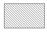 |
|||||||
| Horizontal Hatch |  |
|||||||
| Vertical Hatch |  |
|||||||
| Sand_Pattern | 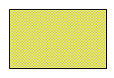 |
|||||||
| Intermittent_Water_Pattern |  |
|||||||
| Salt_Pattern |  |
|||||||
| Coral_Pattern |  |
|||||||
| Black_Cross_Pattern |  |
|||||||
| Black_Dot_Pattern | 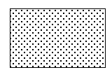 |
|||||||
| Global Mapper Border Styles | ||||||||
|---|---|---|---|---|---|---|---|---|
| Border Style | Example | |||||||
| Solid |  |
|||||||
| Dash | 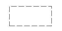 |
|||||||
| Dot | 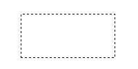 |
|||||||
| Dash - Dot | 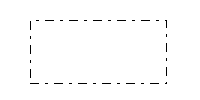 |
|||||||
| Dash - Dot - Dot |  |
|||||||
| Null |  |
|||||||
| Railroad | 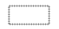 |
|||||||
| Striped |  |
|||||||
| Comb (Left Only) |  |
|||||||
| Comb (Right Only) |  |
|||||||
| Comb (Long Teeth, Left Only) | 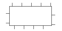 |
|||||||
| Comb (Long_Teeth, Right Only) |  |
|||||||
| Comb (Widely Spaced, Left Only) |  |
|||||||
| Comb (Widely Spaced, Right Only) |  |
|||||||
| Comb (Long & Short Teeth, Left Only) |  |
|||||||
| Comb (Long & Short Teeth, Right Only) |  |
|||||||
| Comb (Double Teeth, Left Only) |  |
|||||||
| Comb (Double Teeth, Right Only) | 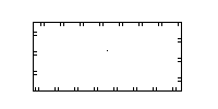 |
|||||||
| Comb (Triplet, Left Only) |  |
|||||||
| Comb (Triplet, Right Only) | 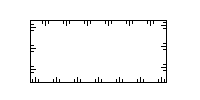 |
|||||||
| Rake (Narrow Spaced, Left Only) |  |
|||||||
| Rake (Narrow Spaced, Right Only) | 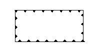 |
|||||||
| Rake (Widely Spaced, Left Only) |  |
|||||||
| Rake (Widely Spaced, Right Only) | 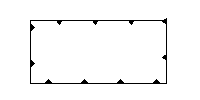 |
|||||||
| Solid with Minus Signs on Left |  |
|||||||
| Solid with Minus Signs on Right |  |
|||||||
| Solid with Plus Signs on Left | 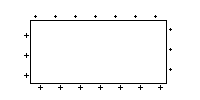 |
|||||||
| Solid with Plus Signs on Right |  |
|||||||
| Solid with Dots on Left |  |
|||||||
| Solid with Dots on Right |  |
|||||||
| Solid with Ts on Left | 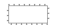 |
|||||||
| Solid with Ts on Right |  |
|||||||
| Solid with Rectangles on Left |  |
|||||||
| Solid with Rectangles on Right |  |
|||||||
| Solid with Squares on Left |  |
|||||||
| Solid with Squares on Right |  |
|||||||
| Half Circles (Tightly Spaced, Left Only) |  |
|||||||
| Half Circles (Tightly Spaced, Right Only) |  |
|||||||
| Half Circles (Widely Spaced, Left Only) | 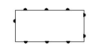 |
|||||||
| Half Circles (Widely Spaced, Right Only) | 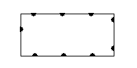 |
|||||||
| Solid with Diamonds on Left | 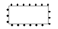 |
|||||||
| Solid with Diamonds on Right | 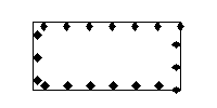 |
|||||||
| V Track (Opens Towards End of Null Line) |  |
|||||||
| V Track (Opens Towards Start of Null Line) | 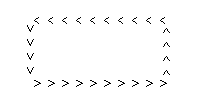 |
|||||||
| C Track (Opens Towards End of Line) | 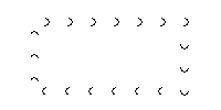 |
|||||||
| C Track (Opens Towards Start of Line) | 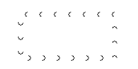 |
|||||||
| Arrow Track (Points Towards Start of Line) | ||||||||
| Arrow Track (Points Towards End of Line) | ||||||||
| V Track (Opens Towards End of Solid Line) | 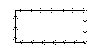 |
|||||||
| V Track (Opens Towards Start of Solid Line) | 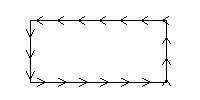 |
|||||||
| Solid with Xs Through Line |  |
|||||||
| Solid with Diamonds along Line | 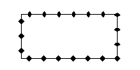 |
|||||||
| Solid with Empty Diamonds along Line | ||||||||
| Solid with Circles along Line |  |
|||||||
| Solid with Empty Circles along Line | ||||||||
| Solid with Arrow Pointing to Start | ||||||||
| Solid with Arrow Pointing to End | ||||||||
| Solid with Empty Circle at Start | ||||||||
| Solid with Empty Circle at End | ||||||||
| Solid with Black Edges |  |
|||||||
Using the Line Styles panel users can configure how lines of a given type will be displayed in Global Mapper. The line style, width, color, and label font can be modified on a type-by-type basis. In addition, the Show Labels for Lines of This Type option allows users to turn line labels off on a type-by-type basis.
The Display Roads As Fat Lines When Zoomed In option allows users to turn on/off the "fattening" of road lines when zoom in tight on them.
Global Mapper's Line Types are listed in the Global Mapper Line Types table. Drawing Styles are listed in the Global Mapper Drawing Styles table.
Global Mapper recognizes four field attributes as containing information for the display appearence of a Line Type. They are:
GM_TYPE=Airport Runway
LINE_WIDTH=1
LINE_COLOR=RGB(0,0,0)
LINE_STYLE=Solid
The "LINE_STYLE=" field attribute can be set to any one of the 60 Drawing Styles shown in the Global Mapper Drawing Styles table.
Upper line shows line types normal appearance. Lower line shows how line type appears when "Display Roads As Fat Lines When Zoomed In" option is checked and display is zoomed in.
Global Mapper's View --> Background Color... color designation influences which lines can be seen. Any line whose color is the same as the Global Mapper Backgrond Color will not be seen. Example, for a white Background Color (RGB 255,255,255), the Processing/Closure Line will not be visible.
| Global Mapper Built-In Line Types | ||||||||
|---|---|---|---|---|---|---|---|---|
| Line Type | Example | Drawing Style | Line Width | Line Color | ||||
| Airport Runway |  |
Solid | 1 | 0,0,0 | ||||
| Alley or Driveway |  |
Solid | 1 | 128,128,128 | ||||
| Arterial Road |  |
Solid | 2 | 0,128,0 | ||||
| Bathymetric Contour, Intermediate |  |
Solid | 2 | 132,130,255 | ||||
| Bathymetric Contour, Major |  |
Solid | 3 | 132,130,255 | ||||
| Bathymetric Contour, Minor |  |
Solid | 1 | 132,130,255 | ||||
| Bathymetric Contour, Supplementary |  |
Solid | 1 | 132,130,255 | ||||
| City Boundary |  |
Solid | 1 | 0,0,0 | ||||
| Collector Road |  |
Solid | 1 | 255,128,0 | ||||
| Contour Line, Intermediate |  |
Solid | 2 | 128,64,0 | ||||
| Contour Line, Major | 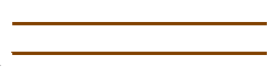 |
Solid | 3 | 128,64,0 | ||||
| Contour Line, Minor |  |
Solid | 1 | 128,64,0 | ||||
| Contour Line, Supplementary |  |
Solid | 1 | 128,64,0 | ||||
| County Route |  |
Solid | 2 | 255,0,255 | ||||
| Deleted Line |  |
Dash | 1 | 192,192,192 | ||||
| Digitizer Tool Line | 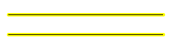 |
Striped | 5 | 255,255,0 | ||||
| Dry Stream or River |  |
Dot | 1 | 0,0,211 | ||||
| Ferry Route |  |
Solid | 1 | 255,128,0 | ||||
| Grid Line |  |
Solid | 1 | 128,128,128 | ||||
| Grid Line - Major |  |
Solid | 2 | 128,128,128 | ||||
| Grid Line - Minor |  |
Solid | 1 | 128,128,128 | ||||
| Intermittent Stream or River |  |
Dash | 1 | 0,0,211 | ||||
| International Political Boundary | 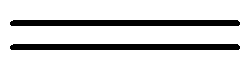 |
Solid | 6 | 0,0,0 | ||||
| Interstate |  |
Solid | 3 | 132,130,255 | ||||
| Invisible Boundary |  |
Dot | 1 | 192,192,192 | ||||
| Major Political Boundary (State) |  |
Solid | 5 | 128,128,128 | ||||
| Major/US Highway |  |
Solid | 2 | 255,64,64 | ||||
| Marine Route |  |
Solid | 1 | 0,0,0 | ||||
| Measurement | 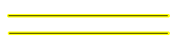 |
Striped | 5 | 255,255,0 | ||||
| Minor Political Boundary (County) | 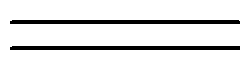 |
Solid | 4 | 0,0,0 | ||||
| Park Boundary |  |
Solid | 1 | 0,255,0 | ||||
| Pipeline |  |
Dash | 1 | 128,128,128 | ||||
| Powerline |  |
Dash - Dot | 1 | 128,128,128 | ||||
| Processing/Closure Line |  |
Solid | 2 | 255,255,255 | ||||
| Railroad |  |
Railroad | 1 | 0,0,0 | ||||
| Railroad, Class 1A |  |
Railroad | 1 | 0,0,0 | ||||
| Railroad, Class 1B | 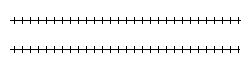 |
Railroad | 1 | 0,0,0 | ||||
| Ramp |  |
Solid | 1 | 0,255,255 | ||||
| Residential Road |  |
Solid | 1 | 128,128,128 | ||||
| River, < 20 km |  |
Solid | 1 | 0,0,211 | ||||
| River, > 250 km | 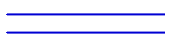 |
Solid | 3 | 0,0,211 | ||||
| River, 100 - 250 km |  |
Solid | 3 | 0,0,211 | ||||
| River, 20 - 50 km |  |
Solid | 2 | 0,0,211 | ||||
| River, 50 - 100 km |  |
Solid | 2 | 0,0,211 | ||||
| River, Unknown Length |  |
Solid | 1 | 0,0,211 | ||||
| Selected Line | 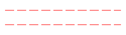 |
Dash | 1 | 2550,0,0 | ||||
| Shoreline |  |
Solid | 1 | 0,0,0 | ||||
| State Highway |  |
Solid | 2 | 255,0,255 | ||||
| Stream |  |
Solid | 1 | 0,0,211 | ||||
| Tracklog |  |
Dash | 1 | 0,0,0 | ||||
| Trail |  |
Solid | 1 | 128,128,128 | ||||
| Unclassified Line Feature |  |
Solid | 1 | 128,128,128 | ||||
| Unknown Line Type |  |
Solid | 1 | 0,0,0 | ||||
| Unpaved Road |  |
Solid | 1 | 128,128,128 | ||||
| Global Mapper Drawing Styles | ||||||||
|---|---|---|---|---|---|---|---|---|
| Drawing Style | Example | |||||||
| Solid |  |
|||||||
| Dash |  |
|||||||
| Dot |  |
|||||||
| Dash - Dot |  |
|||||||
| Dash - Dot - Dot |  |
|||||||
| Null |  |
|||||||
| Railroad |  |
|||||||
| Striped |  |
|||||||
| Comb (Left Only) | 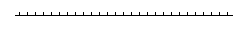 |
|||||||
| Comb (Right Only) | 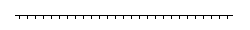 |
|||||||
| Comb (Long Teeth, Left Only) | 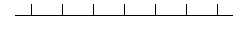 |
|||||||
| Comb (Long Teeth, Right Only) | 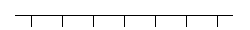 |
|||||||
| Comb (Widely Spaced, Left Only) | 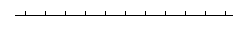 |
|||||||
| Comb (Widely Spaced, Right Only) | 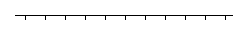 |
|||||||
| Comb (Long & Short Teeth, Left Only) | 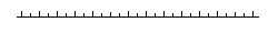 |
|||||||
| Comb (Long & Short Teeth, Right Only) | 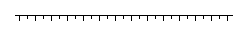 |
|||||||
| Comb (Double Teeth, Left Only) | 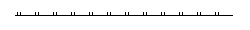 |
|||||||
| Comb (Double Teeth, Right Only) | 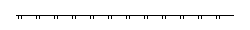 |
|||||||
| Comb (Triplet, Left Only) | 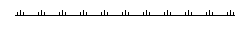 |
|||||||
| Comb (Triplet, Right Only) | 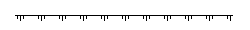 |
|||||||
| Rake (Narrow Spaced, Left Only) | 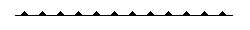 |
|||||||
| Rake (Narrow Spaced, Right Only) |  |
|||||||
| Rake (Widely Spaced, Left Only) | 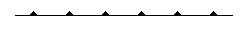 |
|||||||
| Rake (Widely Spaced, Right Only) | 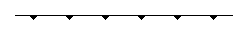 |
|||||||
| Solid with Minus Signs on Left | 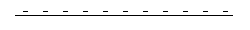 |
|||||||
| Solid with Minus Signs on Right | 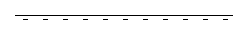 |
|||||||
| Solid with Plus Signs on Left | 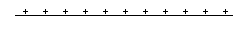 |
|||||||
| Solid with Plus Signs on Right | 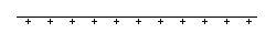 |
|||||||
| Solid with Dots on Left |  |
|||||||
| Solid with Dots on Right | 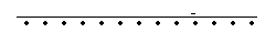 |
|||||||
| Solid with Ts on Left | 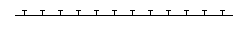 |
|||||||
| Solid with Ts on Right | 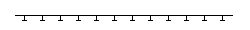 |
|||||||
| Solid with Rectangles on Left | 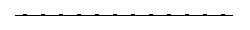 |
|||||||
| Solid with Rectangles on Right |  |
|||||||
| Solid with Squares on Left | 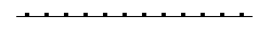 |
|||||||
| Solid with Squares on Right |  |
|||||||
| Half Circles (Tightly Spaced, Left Only) | 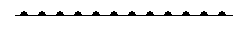 |
|||||||
| Half Circles (Tightly Spaced, Right Only) |  |
|||||||
| Half Circles (Widely Spaced, Left Only) | 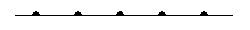 |
|||||||
| Half Circles (Widely Spaced, Right Only) |  |
|||||||
| Solid with Diamonds on Left | 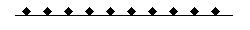 |
|||||||
| Solid with Diamonds on Right | 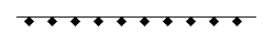 |
|||||||
| V Track (Opens Towards End of Null Line) |  |
|||||||
| V Track (Opens Towards Start of Null Line) |  |
|||||||
| C Track (Opens Towards End of Line) |  |
|||||||
| C Track (Opens Towards Start of Line) |  |
|||||||
| Arrow Track (Points Towards Start of Line) | ||||||||
| Arrow Track (Points Towards End of Line) | ||||||||
| V Track (Opens Towards End of Solid Line) | 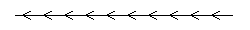 |
|||||||
| V Track (Opens Towards Start of Solid Line) | 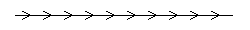 |
|||||||
| Solid with Xs through Line | 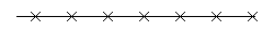 |
|||||||
| Solid with Diamonds along Line | 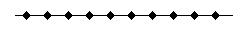 |
|||||||
| Solid with Empty Diamonds along Line | ||||||||
| Solid with Circles along Line | 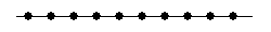 |
|||||||
| Solid with Empty Circles along Line | ||||||||
| Solid with Arrow Pointing to Start | ||||||||
| Solid with Arrow Pointing to End | ||||||||
| Solid with Empty Circle at Start | ||||||||
| Solid with Empty Circle at End | ||||||||
| Solid with Black Edges |  |
|||||||
Using the Point Styles panel users can configure what symbol will be used to display points of a given type. In addition, the Show Labels for Points of This Type option allows a user to turn point labels off on a type-by-type basis. The Custom Symbols section allows users to create new symbols from their own bitmap and icon files which they can then use as the symbol to display for a given type.
Global Mapper's Point Type Features are listed in the Global Mapper Point Type Features table. Symbols are listed in the Global Mapper Symbols table.
Global Mapper recognizes two field attributes as containing information for the display appearence of a Point Type. They are:
GM_TYPE=Address Label
POINT_SYMBOL=Dot - Red
| Global Mapper Built-In Point Type Features | ||||||||
|---|---|---|---|---|---|---|---|---|
| Point Type | Example | Symbol | ||||||
| Address Label |  |
Dot - Red | ||||||
| Airport |  |
Airport | ||||||
| Amusement Center |  |
Amusement Center | ||||||
| Anchorage |  |
Marina | ||||||
| Arch |  |
Arch | ||||||
| Bank |  |
Bank | ||||||
| Beacon | Dot | |||||||
| Boat Ramp |  |
Boat Ramp | ||||||
| Bottom Conditions |  |
Dot | ||||||
| Bridge |  |
Bridge | ||||||
| Building |  |
School | ||||||
| Buoy |  |
Dot | ||||||
| Campground |  |
Campground | ||||||
| Cemetery |  |
Cemetery | ||||||
| Church |  |
Church | ||||||
| City, < 10K |  |
Dot | ||||||
| City, > 10M |  |
Dot | ||||||
| City, 100K - 500K |  |
Dot | ||||||
| City, 10K - 50K |  |
Dot | ||||||
| City, 1M - 10M |  |
Dot | ||||||
| City, 500K - 1M |  |
Dot | ||||||
| City, 50K - 100K |  |
Dot | ||||||
| City, Population Unknown |  |
Dot | ||||||
| Cliff |  |
Cliff | ||||||
| Country |  |
Dot | ||||||
| County |  |
Dot | ||||||
| Dam |  |
Dam | ||||||
| Danger |  |
Dot | ||||||
| First Aid |  |
Hospital | ||||||
| Geyser |  |
Geyser | ||||||
| Golf Course |  |
Golf | ||||||
| Hospital |  |
Hospital | ||||||
| Island |  |
Dot | ||||||
| Land Grant |  |
Dot | ||||||
| Landmark |  |
Dot | ||||||
| Library |  |
Library | ||||||
| LIDAR, Building |  |
Elevation Shaded | ||||||
| LIDAR, Ground Shot |  |
Elevation Shaded | ||||||
| LIDAR, Power Lines |  |
Elevation Shaded | ||||||
| LIDAR, Towers or Poles |  |
Elevation Shaded | ||||||
| LIDAR, Unuclassified |  |
Elevation Shaded | ||||||
| LIDAR, Vegetation (High) |  |
Elevation Shaded | ||||||
| LIDAR, Vegetation (Low) |  |
Elevation Shaded | ||||||
| LIDAR, Vegetation (Medium) |  |
Elevation Shaded | ||||||
| LIDAR, Water |  |
Elevation Shaded | ||||||
| Lighthouse |  |
Lighthouse | ||||||
| Lodging |  |
Lodging | ||||||
| Marina |  |
Marina | ||||||
| Military Installation |  |
Dot | ||||||
| Mine |  |
Mine | ||||||
| Park |  |
Park | ||||||
| Picnic Area |  |
Picnic Area | ||||||
| Picture |  |
Scenic View | ||||||
| Post Office |  |
Post Office | ||||||
| Resturant |  |
Resturant | ||||||
| Restrooms |  |
Restrooms | ||||||
| Rock |  |
Rock | ||||||
| School |  |
School | ||||||
| Shopping |  |
Shopping | ||||||
| Spot Elevation |  |
Spot Elevation | ||||||
| Spot Sounding |  |
No Symbol | ||||||
| Stadium |  |
Stadium | ||||||
| State |  |
Dot | ||||||
| Stream Origin |  |
Stream Origin | ||||||
| Summit |  |
Summit | ||||||
| Swimming Area |  |
Swimming Area | ||||||
| Tower |  |
Tower | ||||||
| Unclassified Point Feature |  |
Dot | ||||||
| Unknown Point Feature |  |
Dot | ||||||
| Waterfall |  |
Waterfall | ||||||
| Waypoint |  |
Dot | ||||||
| Weigh Station |  |
Weigh Station | ||||||
| Well |  |
Well | ||||||
| Wreck |  |
Wreck | ||||||
| Global Mapper Built-In Symbols | ||||||||
|---|---|---|---|---|---|---|---|---|
| Name | Symbol | 2x Sym Details | ||||||
| Airport |  |
 |
||||||
| Amusement Center |  |
 |
||||||
| Arch |  |
 |
||||||
| Auto Rental |  |
 |
||||||
| Bank |  |
 |
||||||
| Beacon | ||||||||
| Big Red X |  |
 |
||||||
| Big Yellow X |  |
 |
||||||
| Boat Ramp |  |
 |
||||||
| Bridge |  |
 |
||||||
| Bullseye |  |
 |
||||||
| Campground |  |
 |
||||||
| Cemetry |  |
 |
||||||
| Church |  |
 |
||||||
| Cliff |  |
 |
||||||
| Dam |  |
 |
||||||
| Danger Area |  |
 |
||||||
| Deer |  |
 |
||||||
| Diag Crosshair - Red |  |
 |
||||||
| Diag Crosshair - Yellow |  |
 |
||||||
| Dot |  |
 |
||||||
| Dot - Blue |  |
 |
||||||
| Dot - Green |  |
 |
||||||
| Dot - Red |  |
 |
||||||
| Dot - White |  |
 |
||||||
| Dot - Yellow |  |
 |
||||||
| Elevation Shaded |  |
 |
||||||
| Fish |  |
 |
||||||
| Fuel |  |
 |
||||||
| Geyser |  |
 |
||||||
| Golf |  |
 |
||||||
| Hospital |  |
 |
||||||
| Library |  |
 |
||||||
| Lighthouse |  |
 |
||||||
| Little Blue X |  |
 |
||||||
| Lodging |  |
 |
||||||
| Marina |  |
 |
||||||
| Mine |  |
 |
||||||
| No Symbol |  |
 |
||||||
| Park |  |
 |
||||||
| Phone |  |
 |
||||||
| Picnic Area |  |
 |
||||||
| Post Office |  |
 |
||||||
| Resturant |  |
 |
||||||
| Restroom |  |
 |
||||||
| Rock |  |
 |
||||||
| Scenic View |  |
 |
||||||
| School |  |
 |
||||||
| Shopping |  |
 |
||||||
| Skiing |  |
 |
||||||
| Spot Elevation |  |
 |
||||||
| Stadium |  |
 |
||||||
| Stream Origin |  |
 |
||||||
| Summit |  |
 |
||||||
| Swimming Area |  |
 |
||||||
| Tower |  |
 |
||||||
| Waterfall |  |
 |
||||||
| Weigh Station |  |
 |
||||||
| Well |  |
 |
||||||
| Well - Active |  |
 |
||||||
| Well - Active at TD |  |
 |
||||||
| Well - Dryhole |  |
 |
||||||
| Well - Gas |  |
 |
||||||
| Well - Injection |  |
 |
||||||
| Well - Location |  |
 |
||||||
| Well - Oil |  |
 |
||||||
| Well - Oil and Gas |  |
 |
||||||
| Well - Suspended |  |
 |
||||||
| Wreck |  |
 |
||||||
| Global Mapper Built-In Symbols | ||||||||
|---|---|---|---|---|---|---|---|---|
| Name | Symbol | 2X Sym Details | ||||||
| Geology - Arrow (Medium, Aqua) | ||||||||
| Geology - Arrow (Medium, Black) | ||||||||
| Geology - Arrow (Medium, Green) | ||||||||
| Geology - Arrow (Medium, Red) | ||||||||
| Geology - Arrow (Small, Aqua) | ||||||||
| Geology - Arrow (Small, Black) | ||||||||
| Geology - Arrow (Small, Green) | ||||||||
| Geology - Arrow (Small, Red) | ||||||||
| Geology - Cleavage (Medium, Aqua) |  |
 |
||||||
| Geology - Cleavage (Medium, Black) |  |
 |
||||||
| Geology - Cleavage (Medium, Green) |  |
 |
||||||
| Geology - Cleavage (Medium, Red) |  |
 |
||||||
| Geology - Cleavage (Small, Aqua) |  |
 |
||||||
| Geology - Cleavage (Small, Black) |  |
 |
||||||
| Geology - Cleavage (Small, Green) |  |
 |
||||||
| Geology - Cleavage (Small, Red) |  |
 |
||||||
| Geology - Dip, Bedding (Medium, Aqua) |  |
 |
||||||
| Geology - Dip, Bedding (Medium, Black) |  |
 |
||||||
| Geology - Dip, Bedding (Medium, Green) |  |
 |
||||||
| Geology - Dip, Bedding (Medium, Red) |  |
 |
||||||
| Geology - Dip, Bedding (Small, Aqua) |  |
 |
||||||
| Geology - Dip, Bedding (Small, Black) |  |
 |
||||||
| Geology - Dip, Bedding (Small, Green) |  |
 |
||||||
| Geology - Dip, Bedding (Small, Red) |  |
 |
||||||
| Geology - Dip, Overturned (Medium, Aqua) |  |
 |
||||||
| Geology - Dip, Overturned (Medium, Black) |  |
 |
||||||
| Geology - Dip, Overturned (Medium, Green) |  |
 |
||||||
| Geology - Dip, Overturned (Medium, Red) |  |
 |
||||||
| Geology - Dip, Overturned (Small, Aqua) |  |
 |
||||||
| Geology - Dip, Overturned (Small, Black) |  |
 |
||||||
| Geology - Dip, Overturned (Small, Green) |  |
 |
||||||
| Geology - Dip, Overturned (Small, Red) |  |
 |
||||||
| Geology - Foliation, Closed (Medium, Aqua) |  |
 |
||||||
| Geology - Foliation, Closed (Medium, Black) |  |
 |
||||||
| Geology - Foliation, Closed (Medium, Green) |  |
 |
||||||
| Geology - Foliation, Closed (Medium, Red) |  |
 |
||||||
| Geology - Foliation, Closed (Small, Aqua) |  |
 |
||||||
| Geology - Foliation, Closed (Small, Black) |  |
 |
||||||
| Geology - Foliation, Closed (Small, Green) |  |
 |
||||||
| Geology - Foliation, Closed (Small, Red) |  |
 |
||||||
| Geology - Foliation, Open (Medium, Aqua) |  |
 |
||||||
| Geology - Foliation, Open (Medium, Black) |  |
 |
||||||
| Geology - Foliation, Open (Medium, Green) |  |
 |
||||||
| Geology - Foliation, Open (Medium, Red) |  |
 |
||||||
| Geology - Foliation, Open (Small, Aqua) |  |
 |
||||||
| Geology - Foliation, Open (Small, Black) |  |
 |
||||||
| Geology - Foliation, Open (Small, Green) |  |
 |
||||||
| Geology - Foliation, Open (Small, Red) |  |
 |
||||||
| Geology - Horizontal Bedding (Medium, Aqua) |  |
 |
||||||
| Geology - Horizontal Bedding (Medium, Black) |  |
 |
||||||
| Geology - Horizontal Bedding (Medium, Green) |  |
 |
||||||
| Geology - Horizontal Bedding (Medium, Red) |  |
 |
||||||
| Geology - Horizontal Bedding (Small, Aqua) |  |
 |
||||||
| Geology - Horizontal Bedding (Small, Black) |  |
 |
||||||
| Geology - Horizontal Bedding (Small, Green) |  |
 |
||||||
| Geology - Horizontal Bedding (Small, Red) |  |
 |
||||||
| Geology - Joint, Closed (Medium, Aqua) |  |
 |
||||||
| Geology - Joint, Closed (Medium, Black) |  |
 |
||||||
| Geology - Joint, Closed (Medium, Green) |  |
 |
||||||
| Geology - Joint, Closed (Medium, Red) |  |
 |
||||||
| Geology - Joint, Closed (Small, Aqua) |  |
 |
||||||
| Geology - Joint, Closed (Small, Black) |  |
 |
||||||
| Geology - Joint, Closed (Small, Green) |  |
 |
||||||
| Geology - Joint, Closed (Small, Red) |  |
 |
||||||
| Geology - Joint, Open (Medium, Aqua) |  |
 |
||||||
| Geology - Joint, Open (Medium, Black) |  |
 |
||||||
| Geology - Joint, Open (Medium, Green) |  |
 |
||||||
| Geology - Joint, Open (Medium, Red) |  |
 |
||||||
| Geology - Joint, Open (Small, Aqua) |  |
 |
||||||
| Geology - Joint, Open (Small, Black) |  |
 |
||||||
| Geology - Joint, Open (Small, Green) |  |
 |
||||||
| Geology - Joint, Open (Small, Red) |  |
 |
||||||
| Geology - Vertical Bedding (Medium, Aqua) |  |
 |
||||||
| Geology - Vertical Bedding (Medium, Black) |  |
 |
||||||
| Geology - Vertical Bedding (Medium, Green) |  |
 |
||||||
| Geology - Vertical Bedding (Medium, Red) |  |
 |
||||||
| Geology - Vertical Bedding (Small, Aqua) |  |
 |
||||||
| Geology - Vertical Bedding (Small, Black) |  |
 |
||||||
| Geology - Vertical Bedding (Small, Green) |  |
 |
||||||
| Geology - Vertical Bedding (Small, Red) |  |
 |
||||||