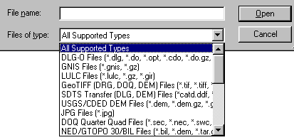
Choose [Open as New] icon from the Toolbar. An open window will appear. This window can be set to display only files of selected types with the "Files of Type:" subwindow.
There is support for opening USGS DLG-O, DEM, and several other file types directly from gzipped archives. In addition, SDTS DLG, SDTS DEM, and most other file types can be opened directly from .tar.gz, .tgz, and .zip archive files. This means that you no longer need to extract all of those SDTS files to their own directory before opening them. Global Mapper will do that automatically.
Loading Multiple FilesGlobal Mapper will display multiple data sets in correct geospatial positions; that is, adjacent data sets can be mosaicked, and vector data can be displayed on top of raster and elevation data.
Choose [Open Data Files] icon from the Toolbar and select files. The registered version Global Mapper has no limit on the number of overlays that can be viewed simultaneously. A maximum of four files of any type may be viewed simultaneously in the unregistered version of Global Mapper.
You can also load all of the files under a directory and all subdirectories under that directory that match a specified filename mask. You can do this using the [Open All Files in a Directory Tree] File menu command.
Projections and DatumsThe Global Mapper display space adopts the coordinate system of the first data set opened. Subsequent data sets will be transformed to the coordinate system of the first data set loaded or the display projection subsequently selected from the configuration dialog.
This is a very powerful feature; it makes differences in projections and datums transparent to the user. This also means that the order in which data sets are loaded can have a significant impact on the appearance of the display. This is the most obvious when working with data sets of widely varying scales.